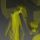
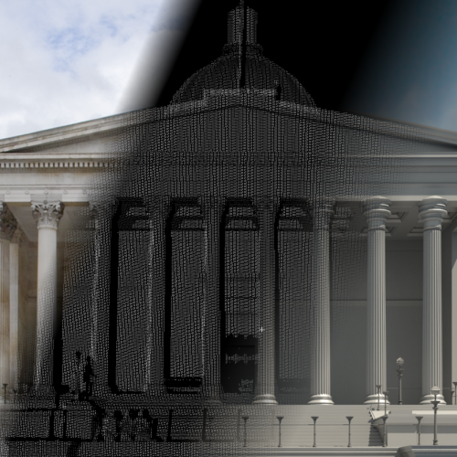
Scan-to-BIM
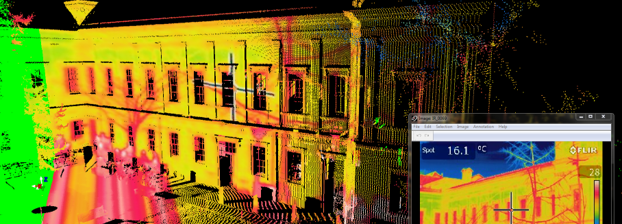
Chadwick GreenBIM
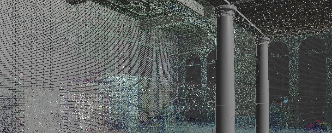
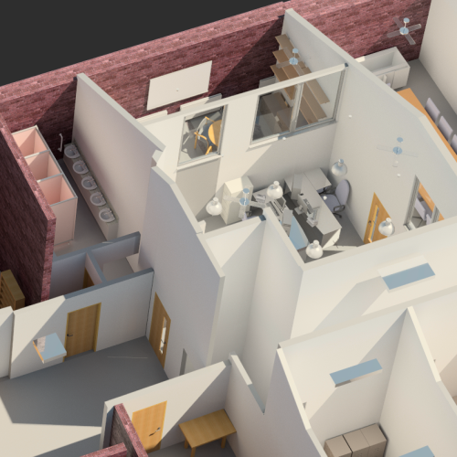
Indoor Mobile Mapping
Since March 2011 I have worked with colleagues within the department to establish BIM as a relevant subject. This involved gaining a good foundation knowledge while establishing links to industry partners for case studies into how laser scanning could be best utilised. Also a Higher Education London Outreach (HELO) project was set up with UCL Advances and an SME to advise them on the integration of laser scanning towards BIM production in their company. From this initial groundwork I was offered a MPhil/PhD studentship. My research looks into Building Information Modelling and automating the processes of real world data capture to facilitate the BIM workflow using 3D Laser Scanning. I also participate as an active member of the Government BIM Task Group on Laser Scanning.

The Civil, Environmental and Geomatic Engineering Department (CEGE) at UCL has seen the industrial consensus forming around BIM and felt it important to perform multi-disciplinary research in this field. The topic has the potential of bringing together interests from across the CEGE department and my PhD studentship is the first step towards this.

2015
Thomson, C., Boehm, J.: Automatic Geometry Generation from Point Clouds for BIM. Remote Sensing 7(9), 11753-11775. 2015. doi:10.3390/rs70911753
Boyes G., Thomson C., Ellul C.: Integrating BIM and GIS: Exploring the use of IFC space objects and boundaries, GISRUK 2015, Leeds, UK, 15 April 2015 - 17 April 2015. University of Leeds. Link
2014
Thomson C., Boehm J.: Indoor Modelling Benchmark for 3D Geometry Extraction, ISPRS Technical Commission V Symposium, Riva del Garda, Italy, 23 Jun 2014 - 25 Jun 2014. Editors: Remondino F, Menna F. ISPRS - International Archives of the Photogrammetry, Remote Sensing and Spatial Information Sciences. XL-5: 581-587. 2014, doi:10.5194/isprsarchives-XL-5-581-2014 [Benchmark Data]
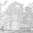
Backes D., Thomson C., Malki-Epshtein L., Boehm J.: Chadwick GreenBIM: Advancing Operational Understanding of Historical Buildings with BIM to Support Sustainable Use Building Simulation & Optimization Conference (BSO14), London, UK, 23 Jun 2014 - 24 Jun 2014. Editors: Malki-Epsthein L, Spataru C, Marjanovic L, Mumovic D. Proceedings of the 2014 Building Simulation and Optimization Conference, 23-24 June 2014. University College London. Link
2013
Thomson, C., Apostolopoulos, G., Backes, D., and Boehm, J.: Mobile Laser Scanning for Indoor Modelling, ISPRS Ann. Photogramm. Remote Sens. Spatial Inf. Sci., II-5/W2, 289-293, doi:10.5194/isprsannals-II-5-W2-289-2013
BIM has been gaining momentum recently in the UK construction industry, especially with impending government legislation. Much work in this area currently focuses on implementing BIM to a new build project. However up to half of all construction work involves retrofitting an existing structure [HM Cabinet Office, 2011]. The most efficient capture of 3D data currently is with a 3D laser scanner. However currently a parametric model is often required and needs to be generated from this point cloud data. This process is usually called 'Scan-to-BIM', however it is more correctly scan-to-parametric model as much of the semantics is added later. A preliminary case study was conducted with Gleeds Land Surveying in the ground floor of their Central London offices. This project implemented laser scanning to gain an understanding of the challenges in the process used to generate the initial geometry for a Building Information Model.
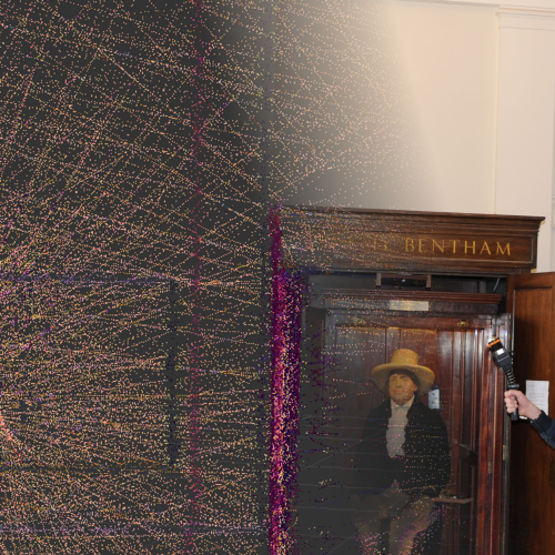
The Green Building Information Model (Green BIM) project focuses on the Chadwick Building, a Grade 1 listed building and home to the CEGE Department. A digital parametric model of the building will be created derived from laser scanning in order to investigate and improve sustainability issues related to the building. We attempt to enhance the vector model into a BIM with semantic information including thermal imagery, building services data, CFD and more. The project is a part of CEGE's Smart Green Action Plan and is supported by multiple partners.
As part of a working group we are investigating the great potential of indoor mobile mapping systems for providing 3D capture of the complex and unique environment that exists inside buildings. The investigation is taking the form of a series of trials to explore the technical capabilities of Indoor Mobile Mapping Systems, such as the i-MMS from Viametris, with a view to performance in Survey and BIM applications with respect to UK standards. The working group is investigating the potential of such technology in terms of accuracies, economic viability and its future development.
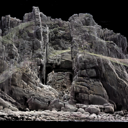
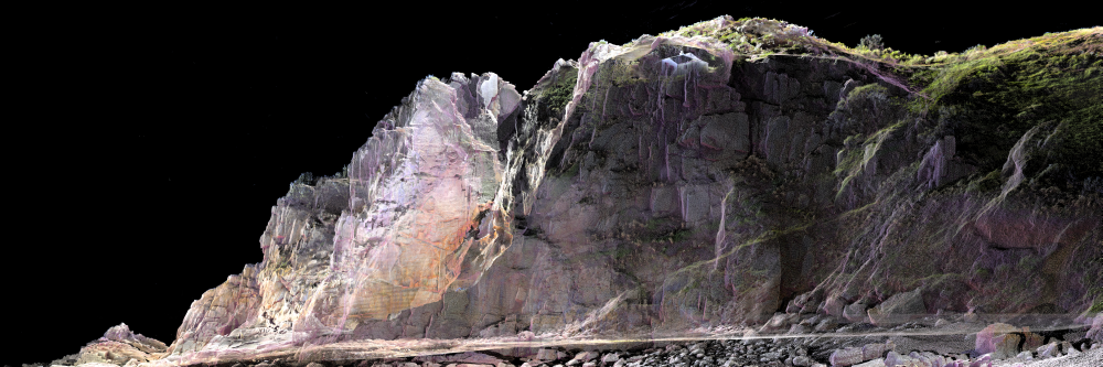
This project involved the capture of an important headland that was under threat from erosion in St. Brelade, Jersey. The Faro x330 was used to capture the full extent of the headland from 40 scans that were tied together with a control survey. The pointcloud dataset is to be used for the planning of engineering works to protect the structure from winter storms. Read More...
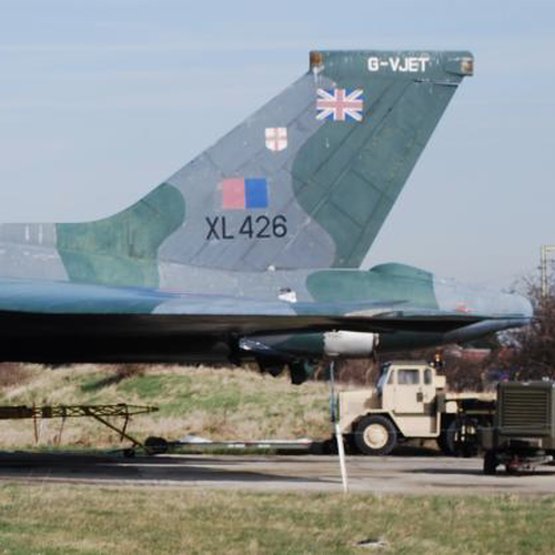
Laser scanning is now an established technology in many fields of engineering. Heritage is one of these areas, where much research has been generated with both close range and terrestrial instruments. However heritage is generally used to mean buildings or sculptures that are of cultural importance, where laser scanning can play a useful role. This work suggests historic aircraft, in this case a Vulcan bomber, as another object of cultural value where laser scanning may be deemed to give an advantage over current conservation techniques. The project made use of a triangulation-based scanner on a CMM arm and a phase-based terrestrial scanner to investigate their applicability for capturing the geometry of the jet pipe end caps of a Vulcan bomber, a part that is increasingly becoming rare and therefore many need refurbishment and re-engineering in the near future.